
Maps of Albany, NY Beginning in 1676
Webpage by Cliff Lamere October 2008
Albany in 1676 - French map
| Joncaer Straet = State St. | Poert = gate |
| Rom Straet = Maiden Lane | Brug = bridge |
| Huysen = houses | Voet = ?? |
Corps de Garde = "body of soldiers" = ?first Fort Frederick made of wood?
The Corps de Garde is in the middle of N. Pearl St. at the junction with State St.
The city is surrounded by palisades (stockade)
1686 Leonard Tantillo, artist's inaccurate version (1985)
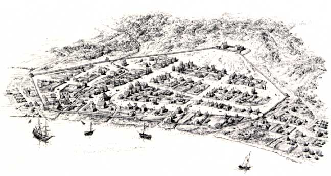
Fort Frederick is shown as a
stockaded fort.  Made of wood. Stone fort came later.
Errors concerning fort:
1) The open land above the houses on the north side of State St., but in contact with them, would become Lodge St. The later stone fort was at Lodge St., so the fort is much too far away from the houses.
2) The stone fort was uphill from the wooden fort. So the depicted wooden fort would have been down around Pearl, perhaps Chapel, in among the houses shown. Tantillo based his map on the 1698 Roemer map of 12 years which showed no houses above Chapel St. Tantillo should not have put in those houses.
Bielinski said, "Overview diagram entitled "Albany, N. Y., 1686," ink on mylar by L. F. Tantillo (1985). This image is based on the Roemer Map of 1698 and on property information derived by the Colonial Albany Social History Project. It represents our ambition to develop materials to help visualize this early American city in one of its earliest incarnations. The diagram was created for the programs supporting the Albany Tricentennial of 1986. Collection of Stefan Bielinski."
1695
1695 Rev. John Miller, chaplain at Fort Frederick
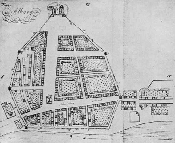
Pearl St. runs north to the gate. Chapel St. would be above the uppermost block of houses. Add another block of the same size above it. That would make the fort right at Lodge St.
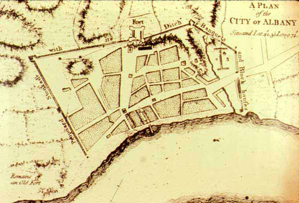
1698 John Wolfgang Roemer

At the corner of Pearl and State, there is something in the general area where the Corps de Garde was located. The fact that it is shown at all on this map means it was something special.
1758
1758 (cropped from a larger map)

1765 British Army Engineer
c. 1770
c. 1770 Robert Yates
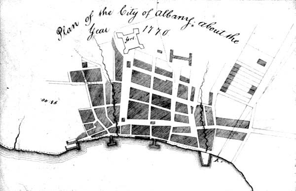
St. Peter's Church and H-shaped hospital present.
c. 1790
c. 1790 Simeon De Witt (map dated 1794)
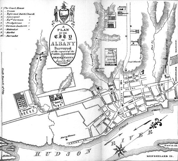
Fort Frederick is not shown, but St. Peter's Church is still in the middle of State St.
1792 John Bogert
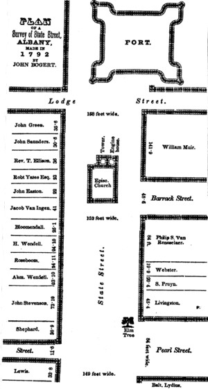
Fort Frederick is shown here, three years after it was possibly torn down. Its possible presence in 1792 is not a surprise to me. St. Peter's was not built or completed until 1802.
This shows the Fire Engine House that was attached to St. Peter's Church. Two years earlier, in 1790, the church had been given deed to the present property in order to get them to move out of the middle of State St. That apparently gave them the right to attach a small building to the church which would soon be rebuilt in its new location. Paul, we should consider the possibility that some of the structures in the middle of streets might be just fire engine houses where firefighting equipment was stored until needed.